Fall Zone
August 8, 2016 by ·
The Fall Zone delineates the boundary between the Coastal Plain and the Piedmont. Here rivers draining the Piedmont drop steeply to sea level and in the process form dramatic rapids.
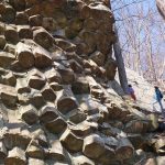
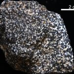
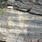
The Neoproterozoic Lynchburg Group
August 7, 2016 by ·
The Neoproterozoic Lynchburg Group is a thick sequence of metasedimentary rocks exposed in the eastern Blue Ridge from northern to south-central Virginia. These deposits range from coarse-grained conglomerate to fine-grained mudstone.
Twenty years of change at Cedar Island
August 6, 2016 by ·
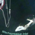
Cedar Island is one of Virginia’s barrier islands that separates the Eastern Shore from the Atlantic Ocean. Barrier islands are dynamic environments that respond quickly to environmental changes. Over time barrier islands move, and their shorelines migrate. During the past two decades shoreline change at the south end of Cedar Island has been dramatic. Compare the 1994 […]