A Resource for Information on the Commonwealth's Geology
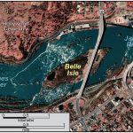
The Fall Zone delineates the boundary between the Coastal Plain and the Piedmont. Here rivers draining the Piedmont drop steeply to sea level and in the process form dramatic rapids.
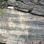
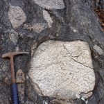
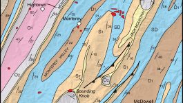
The Neoproterozoic Lynchburg Group is a thick sequence of metasedimentary rocks exposed in the eastern Blue Ridge from northern to south-central Virginia. These deposits range from coarse-grained conglomerate to fine-grained mudstone.
Mount Rogers is the highest peak in Virginia, with its summit 1,746 meters above sea level (5,729 ft). The peak is located in the Blue Ridge province in southwestern Virginia on the border between Grayson and Smyth counties. Mount Rogers is underlain by Neoproterozoic rhyolite. The upper reaches of the mountain are cloaked in alpine forests of red […]
When large quantities of magma intrude and solidify in the Earth’s crust they form bodies of intrusive igneous rock known as plutons. The featured image nicely illustrates the edge (geologic contact) of a granitic pluton in the Blue Ridge Mountains of central Virginia. The granite is part of the 706 ± 4 million year old […]
Copyright © 2024 · Backcountry Child Theme on Genesis Framework · WordPress · Log in