The Fall Zone delineates the boundary between the Coastal Plain and the Piedmont. Here rivers draining the Piedmont drop steeply to sea level and in the process form dramatic rapids.
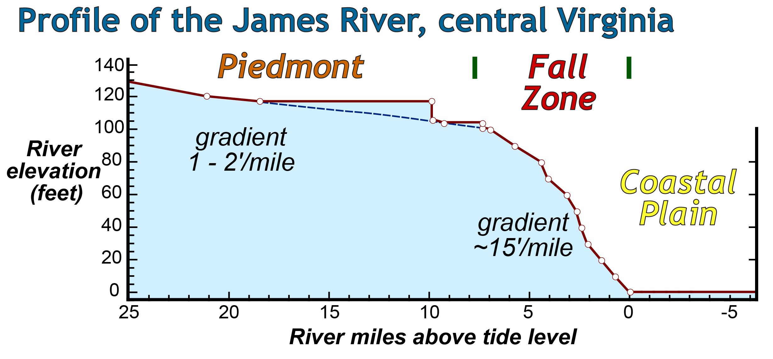
James River profile (red line) from the Piedmont, west of Richmond, through the Fall Zone to the Coastal Plain. Notice the dramatic change in gradient from 1-2’ per mile above the Fall Zone to 14’ per mile in the Fall Zone. The vertical steps in the Piedmont are due to dams along the river, the blue dashed line traces the original pre-dam profile.
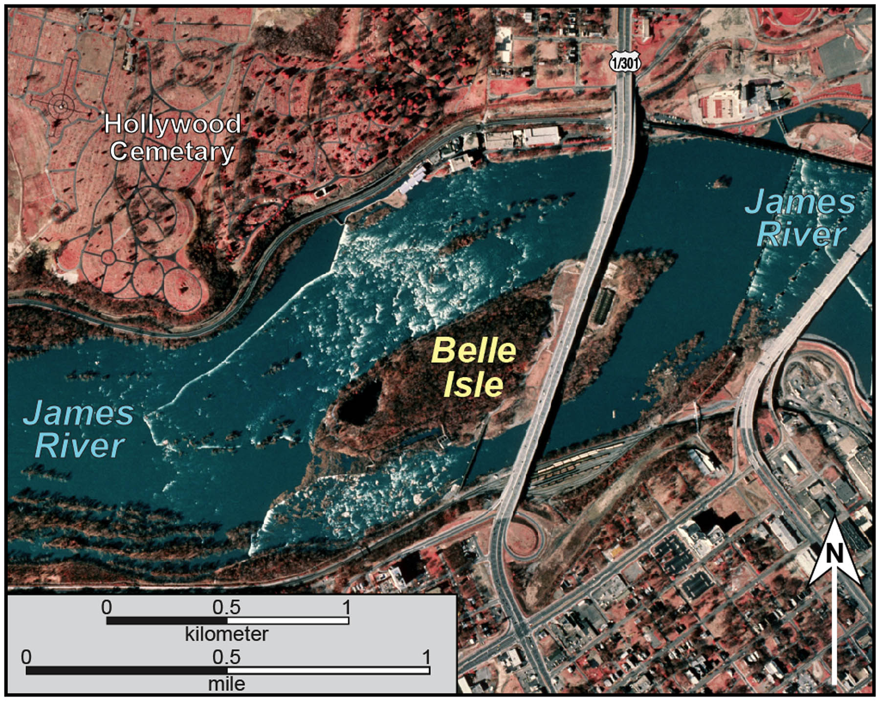
False color imagery of Belle Isle in Richmond, Virginia and the rapids in the Fall Zone.