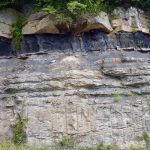
A Resource for Information on the Commonwealth's Geology
Featured Image
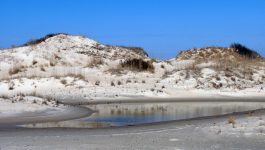
Dunes at False Cape State Park
Dunes are common landforms along Virginia’s sandy coast and its barrier islands.
What’s New in Virginia Geology
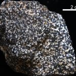
Virginia’s State Rock: Nelsonite
On July 1, 2016, Governor Terry McCauliffe signed a bill into law that made nelsonite the first official state rock of Virginia. The initiative for this project was led by students from Piedmont Virginia Community College. Michelle Stanislaus and her classmates from their Historical Geology class and Government class ran the petition for this law starting […]