The Rappahannock River forms a broad estuary as it flows to towards the Chesapeake Bay in Virginia’s Coastal Plain province. To the south the Piankatank River is also visible. The Rappahannock and Piankatank rivers are tidal estuaries.
A Resource for Information on the Commonwealth's Geology

The Rappahannock River forms a broad estuary as it flows to towards the Chesapeake Bay in Virginia’s Coastal Plain province. To the south the Piankatank River is also visible. The Rappahannock and Piankatank rivers are tidal estuaries.

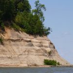
The Cliffs of Westmoreland rise 30 to 45 meters (~100 to 150′) above the waters of the Potomac River. These bluffs expose Miocene to Pliocene sedimentary units, some which are quite fossiliferous. For more information on the geology of Westmoreland checkout the 2005 Virginia Geological Field Conference guidebook by Buck Ward and others. Note the […]

The Rappahannock River forms a broad estuary as it flows to towards the Chesapeake Bay in Virginia’s Coastal Plain province. To the south the Piankatank River is also visible. The Rappahannock and Piankatank rivers are tidal estuaries.

When large quantities of magma intrude and solidify in the Earth’s crust they form bodies of intrusive igneous rock known as plutons. The featured image nicely illustrates the edge (geologic contact) of a granitic pluton in the Blue Ridge Mountains of central Virginia. The granite is part of the 706 ± 4 million year old […]
Copyright © 2026 · Backcountry Child Theme on Genesis Framework · WordPress · Log in