A Resource for Information on the Commonwealth's Geology
Featured Image
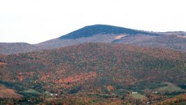
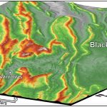
Mount Rogers
Mount Rogers is the highest peak in Virginia, with its summit 1,746 meters above sea level (5,729 ft). The peak is located in the Blue Ridge province in southwestern Virginia on the border between Grayson and Smyth counties. Mount Rogers is underlain by Neoproterozoic rhyolite. The upper reaches of the mountain are cloaked in alpine forests of red […]
What’s New in Virginia Geology
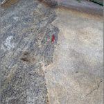
At the Pluton’s Edge
When large quantities of magma intrude and solidify in the Earth’s crust they form bodies of intrusive igneous rock known as plutons. The featured image nicely illustrates the edge (geologic contact) of a granitic pluton in the Blue Ridge Mountains of central Virginia. The granite is part of the 706 ± 4 million year old […]