Seismicity in Virginia
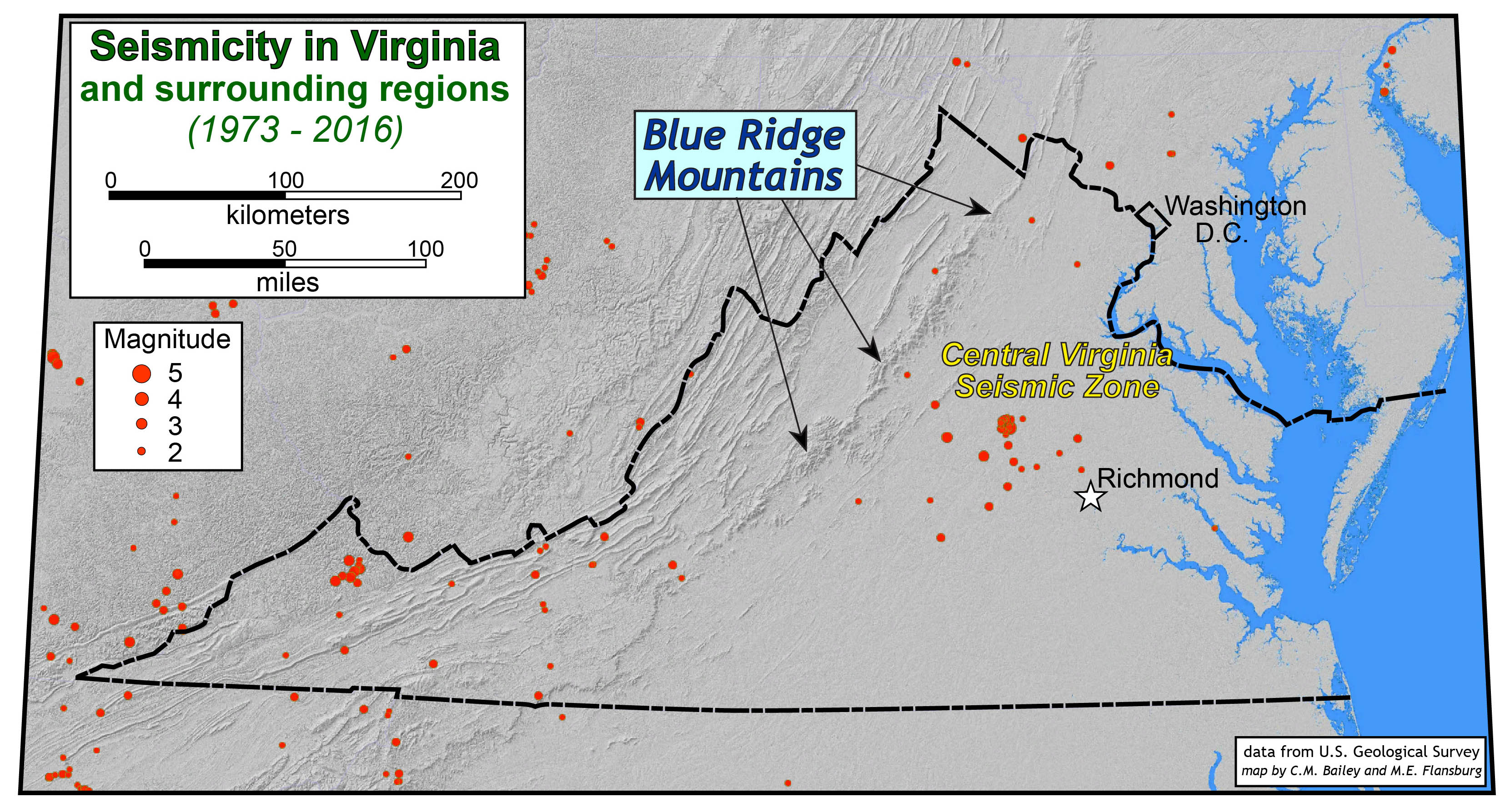
Most people when they think of Earthquakes associate these events with California and the West coast, where there is a major fault, the San Andreas. In comparison, Virginia is situated in the middle of a tectonic plate and rests on a passive margin. This causes several major differences in the types of Earthquakes we have in the Commonwealth. First, the earthquakes occur at much greater depths, ranging from three to fifteen miles beneath the surface, making it difficult to associate it with a specific fault. Second, earthquakes occur much less frequently due to different strain rates. There is a pattern of having large events followed by long periods of no activity. Third, the coherency of the basement rock causes the affected area to be up to ten times larger than a West coast event of a similar magnitude. In short, the earthquake can be felt much farther away from the epicenter. The crust also factors into the movement of Virginia earthquakes: “The Earth’s crust is stronger here, so shock waves moving from the epicenter of an earthquake don’t lose as much energy as during quakes in California.” -Martin Chapman, director of the Virginia Tech Seismological Observatory. However, only 29 earthquakes since 1973 have been large enough to be felt at the Earth’s surface. This is out of 195 that have originated beneath the surface. Below is a map of these earthquakes and the size of their magnitude.
Where can you expect to have earthquakes?
Earthquakes in Virginia are not associated with a specific fault underground, rather they are associated with three major seismic zones: the Central Virginia Seismic Zone (CVSC), the Giles County Seismic Zone (GCSZ), and finally the Eastern Tennessee Seismic Zone (ETSZ).
- CVSC: Located in the central Piedmont alongside the James River, this zone includes the cities of Richmond and Charlottesville as well as the counties of Albemarle, Buckingham, Chesterfield, Cumberland, Fluvanna, Goochland, Hanover, Louisa, Powhatan. This is the largest of the three seismic zones in Virginia.
- GCSZ:This zone lies in Southwestern Virginia borders the state of West Virginia and extends into the New River Valley. It includes the counties of Bland, Carroll, Grayson, Montgomery, Pulaski, and Wythe. Faults in this area trend towards Tennessee, and earthquakes in this zone can be associated with the Narrows Fault, the Saltville Fault, and/or the Holston Valley Fault. According to records, the largest known earthquake in this zone occurred in 1897 and was a magnitude of 5.9
- ETSZ: This zone is the smallest zone in Virginia are reaches the farthest southwestern region containing Lee County. The entirety of the zone extends to northeast Alabama and is one of the most active seismic zones in the eastern United States.
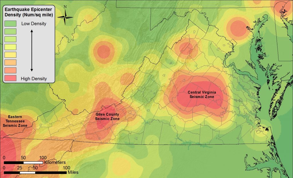
Image taken from the Virginia Department of Mines, Minerals, and Resources.
2011 Eathquake