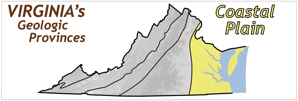
The Coastal Plain extends from the Fall Zone eastward to the Atlantic Ocean. The Fall Zone, is a narrow region where streams cascade off the resistant igneous and metamorphic rocks of the Piedmont onto the younger strata of the Coastal Plain.
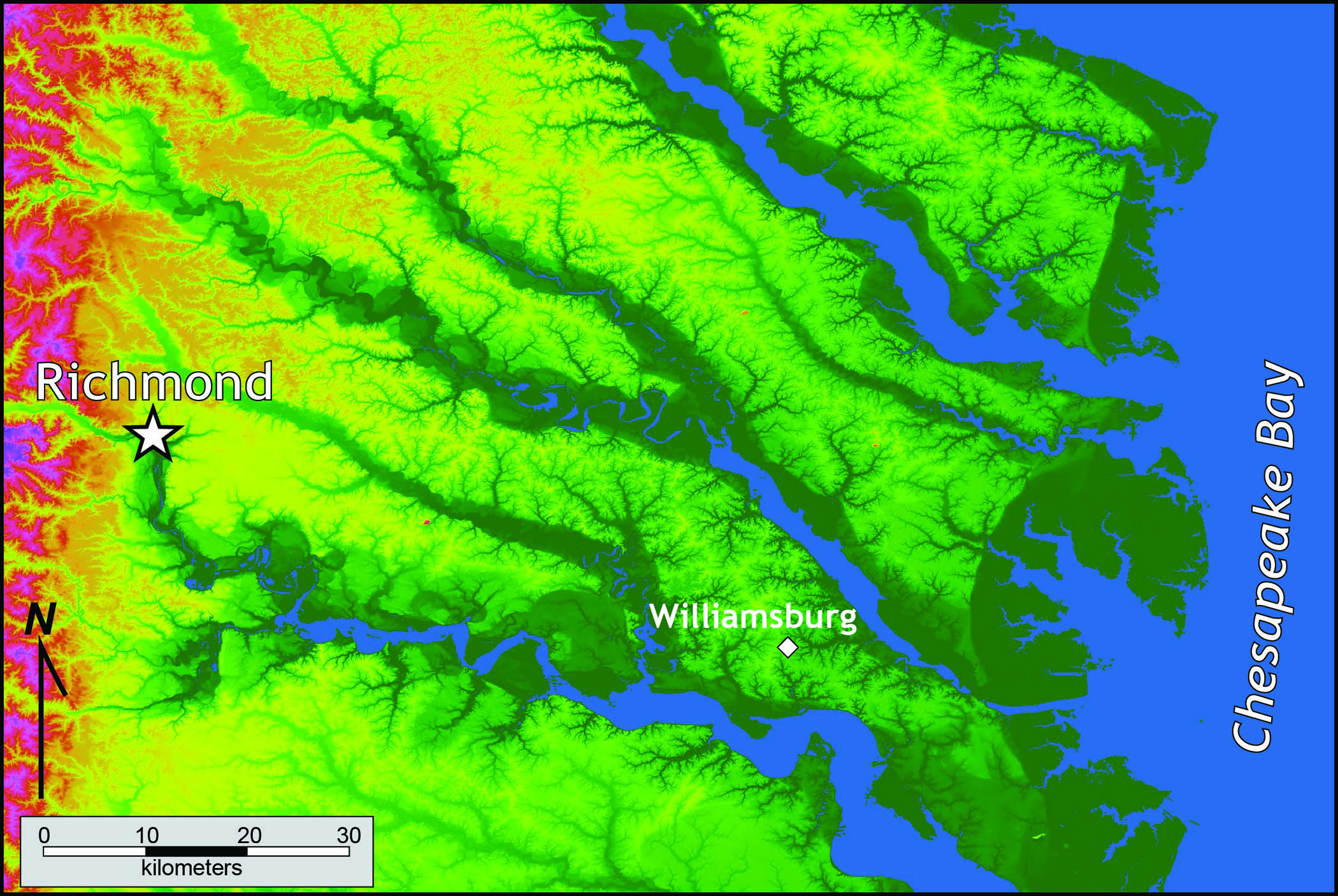
Shaded relief map of the Coastal Plain in east-central Virginia. The James, York, Rappahannock, and Potomac flow southeast to the Chesapeake Bay.
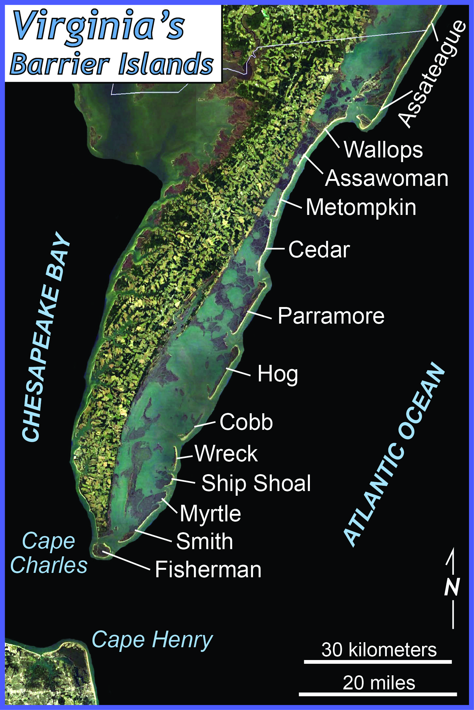
Large tidal rivers, such as the Potomac, Rappahannock, York, and James, flow southeastward across the Coastal Plain to the Chesapeake Bay. The Bay, in turn, empties into the Atlantic Ocean. Low barrier islands frame the Atlantic edge of Virginia’s Eastern Shore.
The Coastal Plain is a terraced landscape that stair-steps down towards the coast and to the major rivers. The ‘steps’ are topographic scarps that formed as ancient shorelines, and the ‘treads’ are emergent bay and river bottoms. The higher, older plains in the western part of the Coastal Plain are more dissected by stream erosion than the lower, younger terrace surfaces to the east. The distinctive Coastal Plain landscape was formed over the last few million years as sea-level rose and fell in response to the repeated melting and growth of large continental glaciers and as the Coastal Plain slowly uplifted. During the last glacial maxima (18 to 22 ka), much of the continental shelf was emergent, and the Susquehanna flowed through the Chesapeake lowland and out across the exposed shelf reaching the Atlantic Ocean 100 km to the east of the modern shoreline. The Chesapeake Bay was created about 5,000 to 6,000 years ago when the lower course of the Susquehanna River was flooded by rising sea level. Continuing sea level rise, land subsidence, and shoreline erosion are on-going hazards Virginia’s coastal setting.
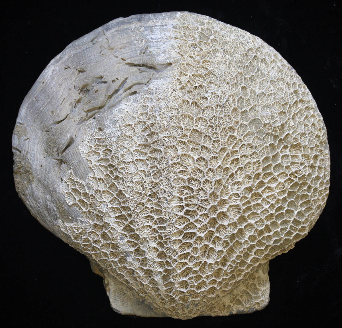
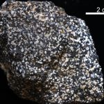
Coastal Plain fossils from Pliocene strata.
The Virginia Coastal Plain is underlain by a wedge of sediments that increases in thickness from a featheredge near the Fall Zone to more than 4,000 meters under the continental shelf. These sediments rest on an eroded surface of older rocks (similar to those exposed in the Piedmont). Two-thirds of this sedimentary wedge is comprised of late Jurassic and Cretaceous clay, sand, and gravel. These materials were eroded off the Appalachian highlands, carried eastward by rivers and deposited in deltas at the margin of newly formed Atlantic Ocean basin. Fossiliferous marine sands of Tertiary age overlie the older strata, and were deposited in warm, shallow seas during repeated marine transgressions across the Coastal Plain.
The Chesapeake Bay Impact Structure was created in a geologic instant when, 35 million years ago, a large meteorite plummeted into a shallow Atlantic Ocean, and excavated a crater more than 90 km in diameter. This massive structure was subsequently buried under >1,000 meters of younger sediment, and was only discovered in the early 1990s.
During the late Tertiary and Quaternary sand, silt, and clay, which cover much of the Coastal Plain, were deposited during interglacial highstands of the sea under conditions similar to those that exist in the modern Chesapeake Bay and its tidal tributaries.