In regards to permissions, please note resource credit to the Virginia Museum of Natural History for the images.
A Resource for Information on the Commonwealth's Geology

The Rappahannock River forms a broad estuary as it flows to towards the Chesapeake Bay in Virginia’s Coastal Plain province. To the south the Piankatank River is also visible. The Rappahannock and Piankatank rivers are tidal estuaries.

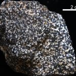
On July 1, 2016, Governor Terry McCauliffe signed a bill into law that made nelsonite the first official state rock of Virginia. The initiative for this project was led by students from Piedmont Virginia Community College. Michelle Stanislaus and her classmates from their Historical Geology class and Government class ran the petition for this law starting […]
Copyright © 2026 · Backcountry Child Theme on Genesis Framework · WordPress · Log in