Virginia is drained by nine major watersheds. A drainage basin is the area of land that catches all forms of precipitation and runoff and drains that water into a major river system. This area of land includes all of the major river’s tributaries. Shown below are the Virginian drainage basins:
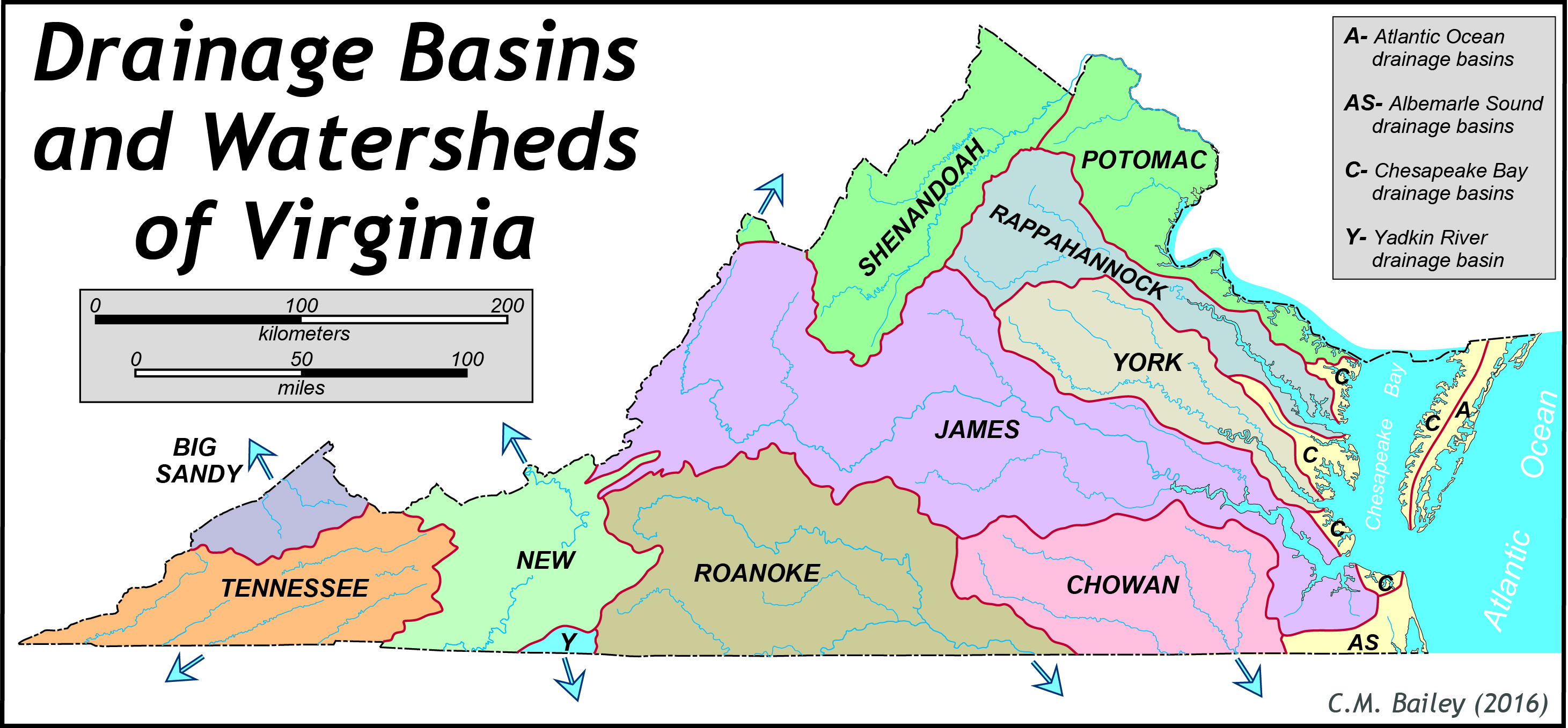
Virginia rivers also are part of three major watersheds of North America: The Chesapeake Bay, the North Carolina Sounds, and the Mississippi River. The main rivers in each of these watersheds are listed below:
- Chesapeake Bay: The Potomac-Shenandoah, Rappahannock, York, and James
- North Carolina sounds: Roanoke, Nottoway, Meherrin (Chowan)
- Mississippi: New River, Holston, Clinch (Tennessee), and Big Sandy
Most of Virginia’s rivers rise in the mountains and flow east-southeast to the Atlantic Ocean or west-southwest into the Tennessee and Ohio River basins. The character of Virginia’s streams is a reflection of the geologic and physiographic province over which they flow. Valley & Ridge streams flow in linear valleys between parallel ridges. Northern Blue Ridge streams fall rapidly from ridge crests to the low country on either side of the range. Only the Potomac, James, and Roanoke Rivers breach the Blue Ridge Mountains. Streams meander across the Piedmont with low to moderate gradients, but drop swiftly to the Coastal Plain in the Fall Zone. On the Coastal Plain streams have low gradients and become wide estuaries as they approach the Chesapeake Bay.
Virginia is a well-watered state receiving approximately one meter (39 inches) of precipitation per year. Much of this water runs off into streams and rivers, while the rest returns as groundwater. The USGS provides current conditions for groundwater in addition to well measurements . Information regarding groundwater characterization from the Virginia Department of Environmental Quality can be found here.